Trip Totals

Total Number of:

Days on the Trip: 33

Miles Ridden: 11,837

Avg. Miles Ridden per Day: 358.70

States Visited/Passed through: 19

Provinces Visited/Passed through: 3

National Parks Visited: 5

Nights in a Hotel: 17

Nights Camping: 8

Nights Staying w/ Family/Friends: 7


Final Days (days 31-33)

Day 31 – Monday, July 30th (580 miles, Thermopolis, WY to Kearney, NE):

With no plans of visiting any attractions today, or the rest of the trip, my goal was to ride as far as I could. I left Thermopolis at about 8am, with great weather, and rode through a small canyon just outside of the town. The road meandered through the canyon, alongside a river and railroad tracks, for about 10 miles. Other than this canyon, there was not much else exciting about the day.

After a long day of riding, I got into Kearney, NE around 10pm, checked into the hotel, and went straight to bed.

Canyon in WY 1 - edited .JPG

Canyon in WY 2 - edited .JPG


Days 32-33 – Tuesday, July 31st – Wednesday, August 1st (1,135 miles, Kearney, NE to Lilburn, GA):

These past two days were spent mostly on major highways, making up as much ground as I could cover. The ride was fairly boring with not much going on, except for a few bad storms I passed through in Illinois and again in Tennessee.

I finally made it back into the Atlanta area on Wednesday afternoon, safely and without issues on my motorcycle, bringing an end to my trip. I hated that this was the end, but it is nice being back in Atlanta!

Beartooth Highway (day 30)

Day 30 – Sunday, July 29th (440 miles, Butte, MT to Thermopolis, WY):

I left Butte, MT around 7:30am this morning and drove for about 3 hours until I reached Red Lodge, MT. Red Lodge is a small town, just north of the Wyoming border, and sits at the eastern side of the Beartooth Highway. It is a beautiful town with lots of things to see and tourist attractions around, definitely worth a visit!

It was sunny and warm when I rode through the town and there must have been at least 100 other motorcyclists there, some about to ride the Beartooth and others that had just ridden the highway. I ran into some light rain as I was about to begin riding the Beartooth Highway, but other than that, I had nice weather most of the day.

Riding up the Beartooth Highway was a little nerve wracking as the road switchbacks up the side of a mountain, with steep drop-offs to the side. There were so many other people in cars and motorcycles on the road, which made for a slower pace for the ride.

When I reached the top of Beartooth Pass, it was very cold and windy and the only thing I could think about was actually getting off the mountain on the other side. It was a beautiful ride, being able to see more mountains (with lots of snow), a few animals, valleys, rivers, lakes, and other scenery.

When I came off the western side of Beartooth Highway, I came to an intersection with one road leading me to Yellowstone National Park and the other road leading me to Cody, WY, via the Chief Joseph Scenic Byway. Since I have been to Yellowstone many times before and hearing that the road to Cody was beautiful, I decided to begin riding on the Chief Joseph Byway.

The Chief Joseph Scenic Byway is another road I would highly recommend taking if you find yourself in the area. The road winds through mountains with great views the entire way. It was also less crowded than the Beartooth Highway, which was nice relief.

After arriving in Cody, I filled up my gas tank and then rode a few more hours to a small town called Thermopolis, WY.

I am now at the point in my trip where I have seen everything that I wanted to see and now the only goal is to make it back to Atlanta.  I will stay in Thermopolis for the night and will begin a long day of riding tomorrow!

Beartooth Highway - edited .JPG

Views from the Beartooth Highway

Chief Joseph Scenic Byway - edited .JPG

Chief Joseph Scenic Byway

Back into the USA (day 29)

Day 29 – Saturday, July 28th (511 miles, Calgary, AB to Butte, MT):

Another great day! This morning I left Calgary around 7:30am and began driving south towards Montana, with the goal of riding through Glacier National Park for the day.

The ride from Calgary to the US/Canada border was rather boring with the scenery mostly consisting of open fields. However, once I got close to reaching Montana, I was able to see the jagged Rocky Mountains in the distance.

Crossing the border for the final time was quick and easy and thankfully I never ran into any issues at the border crossings I came to. Once back in the US, I drove about 20 minutes down to the eastern entrance of Glacier National Park, filled up my gas tank, got a snack, and then headed into the park. For years now, I have been looking forward to seeing Glacier NP and the scenery here. The pictures sure don’t do it justice! It was just as beautiful as I thought it would be.

I rode through the park on the Going-to-the-Sun road, a narrow road that crosses the park, following rivers, mountains, lakes, and at times straight drop-offs to the side of the road. It was an amazing experience to be riding on my motorcycle through the park. I stopped along the road to take pictures of the mountains and different scenery and did my best to avoid all of the other tourists driving around.

The entire drive across the park is very scenic, the views never get old, and the terrain is similar to what I saw in Jasper and Banff. I cant recommend this place enough to anyone who has thought about visiting.

The highest point on the Going-to-the-Sun road is Logan Pass, which has some of the best views on the road. I stopped at Logan Pass for about 20 minutes, walked around some, and took pictures of both sides of the pass. It is crazy how steep some of the drop-offs are, right off the road.

After Logan Pass, I continued heading west for a few hours until I reached the western exit/entrance of Glacier NP, where I filled up my gas again and then continued riding south. My final destination for the night was Butte, MT, about 4 hours south of the park. When I arrived in Butte it was about 10pm, so I checked into my hotel and went straight to bed. Tomorrow I will be riding on the Beartooth Highway, a road that winds through mountains in northern Wyoming, with the goal of reaching Yellowstone National Park.

Glacier NP sign entrance - edited .JPG

Entering Glacier National Park on the eastern side of the park

Glacier NP 1 - edited .JPG

A scenic overlook towards the beginning of my ride into Glacier National Park.

Going to the Sun Road with bike - Glacier NP.JPG

Going-to-the-Sun road, just west of Logan Pass

Going to the Sun Road, Overlook .JPG

East of Logan Pass the road is cut into the mountain side and is very narrow

Going to the sun road - drop off - edited .JPG

Narrow road with a steep drop-off to the left

Jasper and Banff (day 28)

Day 28 – Friday, July 27th (355 miles, Edson, AB to Calgary, AB):

This morning I left my hotel around 6am to get an early start on my day touring Jasper National Park and Banff National Park. I got into Jasper around 7:30am and headed straight up to Maligne Lake, about an hours ride once I was in the park. The ride to the lake was breathtaking, riding past rivers, crystal clear lakes, and jagged mountains. This single area may have taken the cake as the most beautiful place I have come to on this trip.

Once I arrived at the lake, and thankfully before the massive crowds came, I walked on a trail that wraps around part of the lake for about a mile. I got to a lookout point and sat down for a few minutes, taking in the scenery. People were already out on the lake, kayaking, canoeing, and fishing, while quite a few others were walking on the various trails around the lake. I then headed into the restaurant at the nearby lodge, got some coffee, and sat down on the outside patio to enjoy the views of the lake and mountains before driving to other parts of the park.

My next stop in Jasper was back down the mountain a little ways at a lake called Medicine Lake. This is another crystal clear lake, set between mountains on all sides. The road runs right along this lake and is one of the more scenic roads of this trip, with a steep drop off and the lake, both to one side. I stopped for about 20 minutes, got a few pictures, and then headed into the town of Jasper.

After getting gas in Jasper and riding through the town, now swarming with thousands of tourists, I began driving down the Icefield Parkway towards Banff National Park. The Icefield Parkway is about 150 miles long and connects the two national parks, running through massive, jagged mountains, passing rivers, lakes, and glaciers. The entire road is nothing but amazing scenery and is a must-do if visiting wither park.

I must have stopped at least 100 times to see the sights and take pictures while riding on the Icefield Parkway. I couldn’t get over how blue and clear the lakes lakes were and how many ice fields and glaciers I got to see. Truly an amazing experience being able to visit this part of Canada!

Once I got into Banff in the late afternoon, I rode over to Lake Louise, the most popular attraction in Banff. While it is a beautiful place, I stayed there for only a few minutes because there were so many other people there. I generally try to avoid the large crowds and see less visited places, so Lake Louise was not as attractive to me as other parts of the parks. After Lake Louise, I headed into Calgary, where I would be staying for the evening.

Tonight will be my last night in Canada, before I head back into the US and cross the border into Montana. I will definitely miss Canada, in particular British Columbia, and have thoroughly enjoyed my time here!

Maligne Lake 1 - edited .JPG

Beautiful morning walking around Maligne Lake

Maligne Lake 2 - edited .JPG

Road along Medicine Lake - edited .JPG

Riding next Medicine Lake

Medicine Lake  - edited .JPG

Medicine Lake

riding along Icefield Parkway - edited .JPG

Heading south towards Banff on the Icefield Parkway

Icefield parkway - icefields and glaciers - edited .JPG

Ice fields and glaciers throughout the ride today

Icefield Parkway mountains and river - edited .JPG

Motorcycle and mountains on Icefield parkway - edited .JPG

Creek on Icefield parkway - edited .JPG

Jasper NP, blue lake picture .JPG

Overlook on Icefield Parkway - edited

Overlook area on Icefield Parkway

Into Alberta (day 27)

Day 27 – Thursday, July 26th (321 miles, Fort St. John, BC to Edson, AB):

Today was an easier day of riding, with not much diverse scenery to see. Most of the ride was on long, straight roads in the middle of farmland and it reminded me of the plains and open fields in Kansas or one of the flat Midwestern states.

I ran into some light rain in the morning, but other than that it was a clear and warm day. An hour or so into my ride, I came to the famous town of Dawson Creek. This is the beginning of the Alaskan Highway if you are heading north towards Alaska. I stopped to fill up gas and took a few pictures of the Dawson Creek sign and then continued heading east.

When I arrived in Grand Prairie, AB I went to the visitor center to get some coffee and wifi and then quickly got back onto my bike to finish the last few hours of my trip for the day. I eventually made it to Edson, AB, my destination for the night, which sits about an hour or so east of Jasper National Park, checked into my hotel, and called it a night.

Dawson Creek sign - edited .JPG

Arriving into Dawson Creek

Yellow fields in Dawson Creek - edited .JPG

Bright yellow fields just outside of Dawson Creek


Canadian Rockies (day 26)

Day 26 – Wednesday, July 25th (465 miles,Coal River, BC to Fort St. John, BC):

This morning I woke up around 5am after getting into my campsite at 11pm last night and not getting much sleep throughout the night. After packing up my things and getting my motorcycle ready, I grabbed my tent, walked right over to the dumpster at the campsite, and threw my tent in. Every night that I’ve camped on this trip, I’ve woken up with nearly everything in my tent wet. My tent was a single-wall tent, so the condensation was almost impossible to keep out. I finally grew tired enough of waking up in a wet tent and decided it had to go!

The ride today was incredible. Beautiful mountains, glacial lakes, and rivers surrounded me for most of the ride. My first stop for gas today was at the Northern Rockies Lodge on Muncho Lake. This lake and the surrounding area might be the most beautiful place I have come to on this trip so far. The lake sits in the middle of the Canadian Rockies and the water is crystal clear.

I ate breakfast at the Northern Rockies Lodge and as I was getting on my bike to continue riding, I met a group of three older men (two were brothers) who were also on a motorcycle trip. After speaking with them for about 20 minutes, I found out that they live in British Columbia and were on a ride for about a week, visiting different places within the province. The oldest of the three was driving a beautiful KTM motorcycle. As I started asking him questions, he told me that he has ridden around the world on motorcycles multiple times! He has done London to NYC, Alaska to Chile, and ridden in parts of Africa, completing some of these various trips more than once. I was in total amazement. Up until this trip, I did not know much about people riding around the world on their motorcycles (I thought Ewan McGregor and Charley Boorman were the only ones to do this!) , but I have now realized that this is more common than I thought. Its definitely got me thinking about my next big trip!

I spoke with the three gentleman for a few more minutes and then got back on my bike to ride. Over the next few hours, the road continued winding through the Canadian Rockies, passing Stone Mountain Provincial Park, Toad River, and other scenic areas. I made a brief stop in Toad River to fill up my gas tank and met a group of about 15 girls and 2-3 guys that had ridden their bicycles from Austin, TX to BC so far, heading north to Alaska. We traded a few suggestions of things to see, as we were going in opposite directions, and I continued on my way.

As the afternoon progressed, the mountains disappeared and the landscape changed more into open fields that are used for farming. I rode until I arrived in Fort Nelson, where I stopped to get gas and headed to the visitor center for about 30 minutes for the free wifi. Wifi has been hard to get over the past few days! I booked a hotel in Fort St. John (another 4 hours down the road) for the night and got back on the bike.

I arrived in Fort St. John at about 9pm, checked into my hotel, and ordered some food. It was a great day overall, with perfect weather, stunning scenery yet again, and met some unique people great stories.

Goat on road - edited .JPG

Came across this goat shortly a few miles before Muncho Lake

Wooden Map - Northern Rockies Lodge - edited .JPG

A huge wooden map hanging on the wall in Northern Rockies Lodge. It took over 1000 hours to carve the map

Toad River - edited .JPG

Riding along Toad River

Stone Mountain Provincial Park - edited .JPG

Stone Mountain Provincial Park

Summit Lake - Edited .JPG

Summit Lake in Stone Mountain Provincial Park

Sign Post Forest (day 25)

Day 25 – Tuesday, July 24th (645 miles, Beaver Creek, YT, CA to Coal River, BC):

Today was the 2nd most mileage Ive ridden in a single day on this trip. My goal was to cover as much ground as I could so that I can reach Jasper National Park as soon as possible.

I left my cabin in Beaver Creek around 7:45am after a good nights rest and continued riding back south down the Alaskan Highway. I didnt make many stops in the first half of the day since I had ridden north on this road on the way up to Alaska. When I reached Watson Lake around dinner time, which I hadn’t gone through on my way up north, I came to the Sign Post Forest, one of the most unique attractions I have seen on this trip. Sign Post Forest is simply thousands and thousands of street signs, license plates, and other signs from all over the world, mounted on posts about 20 feet high. I walked around the Forest for a few minutes and finally found a few signs from Georgia and some cities within the state. I then headed to a Chinese restaurant just down the street to get some dinner before getting back on the road.

Shortly after leaving Watson Lake, headed south, there are multiple large signs warning of buffalo that inhabit the area. I came to a single buffalo laying on the side of the road and then another single buffalo a few more miles down the road. After about 30 more minutes of riding and approaching 9:30pm, I came to a large herd of maybe 100 buffalo, many of which were standing on the road and preventing me from continuing.

I pulled over to the side of the road and watched the buffalo for a few minutes and took a few pictures. After nearly 20 minutes of waiting and hoping the buffalo would move off of the road so I could ride by, a large semi truck, coming north, was able to scare the buffalo off to the sides of the road, just long enough for me to quickly ride by. This was an interesting experience for sure!

I rode for another hour and a half until I arrived at Coal River, BC and pulled into the first, and I believe only, campsite I came to in the town. After a long day of riding, it was nice to finally be done for the day. I put up my tent and then layed down for bed.

Gas in Burwash Landing - edited .JPGFilling up in Burwash Landing

Black Bear on way back from AK 1.JPG

I rode passed 5 black bears today, this was the first one I saw

Sign Post Forest 1 - edited .JPG

Sign Post Village in Watson Lake

Sign Post Forest 2 - edited .JPG

Found a sign from Conyers, GA

Sign Post Forest 3 - edited .JPG

Thousands of signs

Buffalo on highway - edited .JPG

Buffalo jam

Semi with Buffalo.JPG

Semi trucks clearing the way for me to ride through


Back to the Great White North (day 24)

Day 24 – Monday, July 23rd (415 miles, Eagle River, AK to Beaver Cree, YT, CA):

Today was my last day in Alaska. It as a slightly somber day, with the reality that my trip will be coming to an end soon. My whole trip, starting with the planning a few years ago, to actually making the trip happen, and then finally arriving in Alaska, was all about Alaska. Making it to Alaska was the goal and the challenge. Now it is over.

On my ride today, I reflected on my time in Alaska and the trip leading up to this amazing place. The beginning of my trip seemed like it was such a long time ago, leaving Atlanta and riding through over 100 degrees temperatures everyday across the US. For the past two weeks, I had been waking up to temperatures in the 40’s! There have been some tough times, dealing with the bad weather, or riding on a couple hours of sleep, but I wouldn’t change any of it. By far though, the good times outweighed the few struggles I have encountered.

I left Eagle River after having breakfast with J.J. and Alex and saying goodbye, and began riding northeast on Glenn Highway towards Canada. The first few hours of the ride were pretty, with mountains off in the distance and rivers and lakes off to the side of the road. About the only negative thing on the ride today was the terrible road conditions. I was again surprised at how bad the road was, worse than any others I had ridden on so far (besides the off-roading I did on the Dalton Highway). Many potholes and bumps were spread throughout both sides of the road, hard to avoid at times. It was also a warm day, much warmer than I would have expected in Alaska. When I finally reached Tok in the late afternoon, the temperature was 87 degrees!

After filling my gas tank and eating a snack in Tok, I decided to keep riding until I made it across the border, into Canada, and to the town of Beaver Creek. With no issues crossing the border, I arrived in Beaver Creek, YT around 8pm and got a cabin at Buckshot Bettys. I then grabbed a bite to eat at the restaurant and had dinner with another motorcyclist named Ken, from Toronto. Ken was on his way up to Alaska, so I gave him some suggestions on places to visit and things to do. I then headed to bed after dinner to get ready for a long ride tomorrow!

US:Canada border - edited.JPG

Border between US and Canada

Buckshot Bettys - edited .JPG

Cabin #5 – my cabin for the night at Buckshot Betty’s. Mosquitos were terrible here!

Eagle River (days 21-23)

Day 21 – Friday, July 20th (Eagle River, AK to Cooper Landing, AK):

No riding for the next few days! It will be a nice change of pace to be off the bike and enjoying Alaska with my friends.

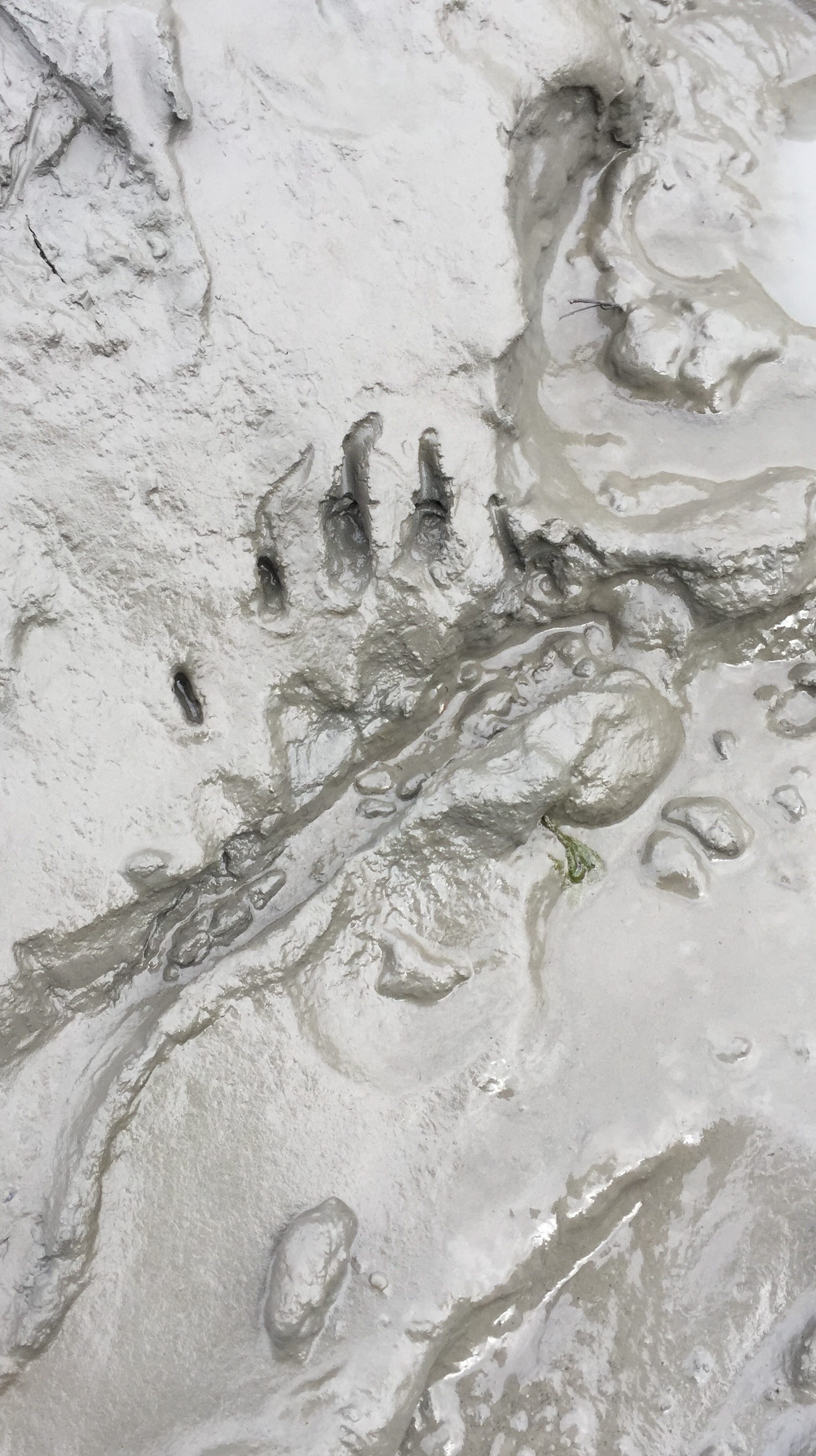
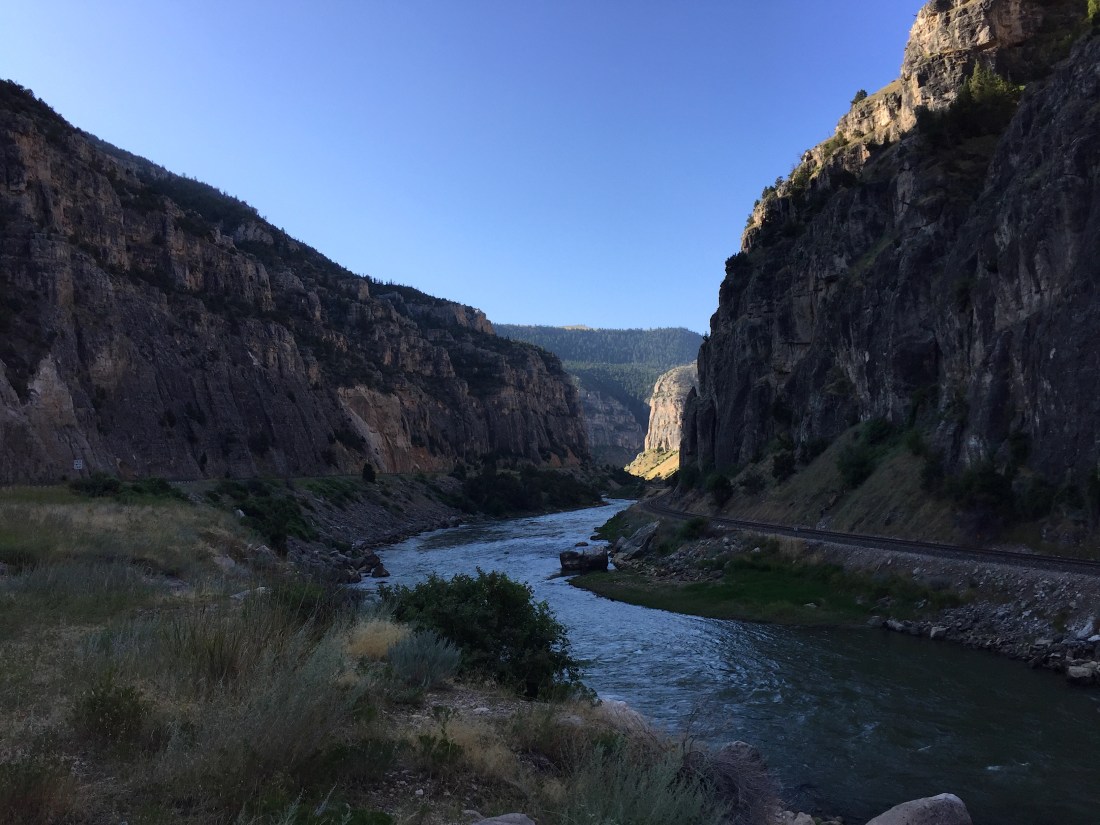
This afternoon, Alex, J.J., and I and I packed up their camper and headed south through Anchorage to the Kenai Peninsula, where we will be camping tonight and fishing for salmon. The drive south of Anchorage took us passed Chickaloon Bay and along the Chugach State Park, both incredible sights to see. When the Chickaloon Bay is experiencing low tide, the water recedes so much that almost the entire bay turns into mud.

We stopped at a few scenic places on the drive to Cooper Landing to take pictures and arrived at our campsite right around dinner time. A few hours later, with the camper set up and dinner eaten, J.J. and I headed out to Russian River around 11pm to start fishing. As soon as we walked down to the river, the very first thing  we saw was a grizzly bear on the opposite side of the river looking for some fish. One of the first grizzlies I have seen on the trip and at a close distance. A few other fisherman were already in the river and were able to scare the bear away before he could steal any of their fish.

We fished until about 2:30am with no luck of catching fish and then headed back to the campsite to get some rest.

JJ car and camper - edited .JPG

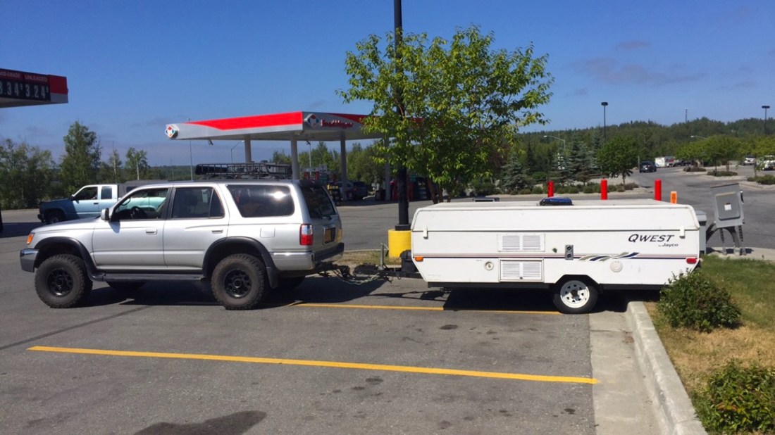
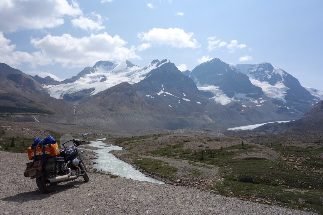
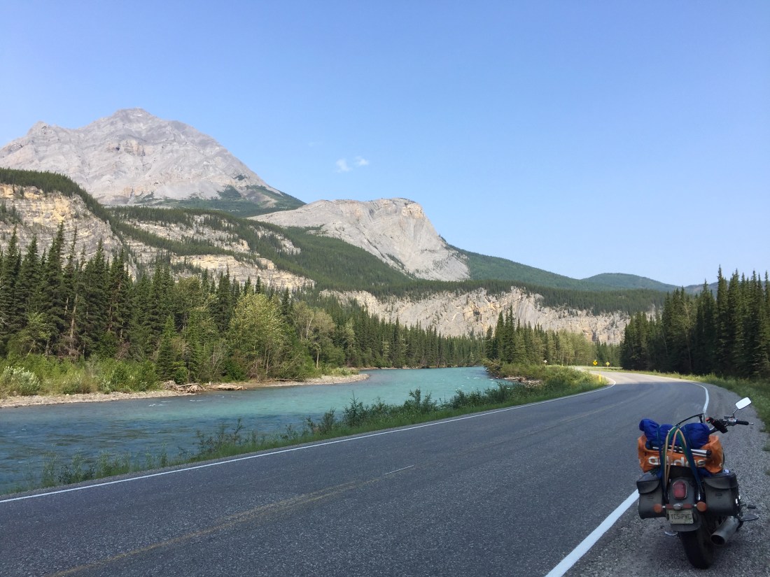
Traded in the motorcycle for the SUV and camper this weekend

On the way to Cooper Landing - edited .JPG

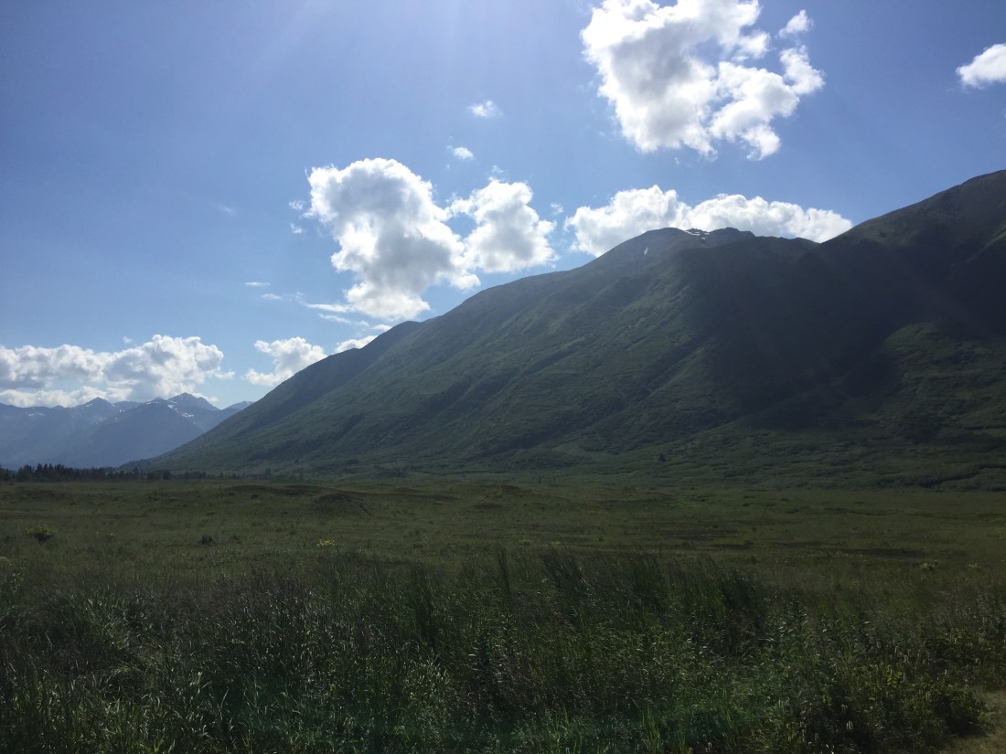
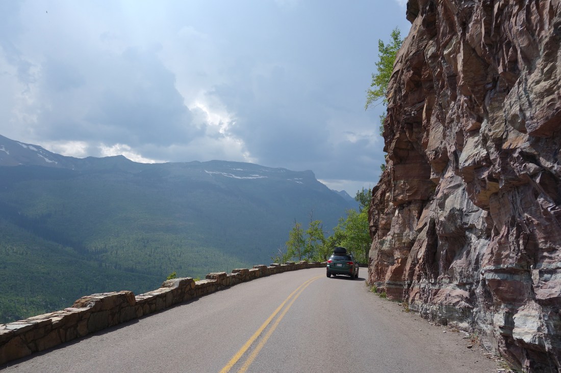
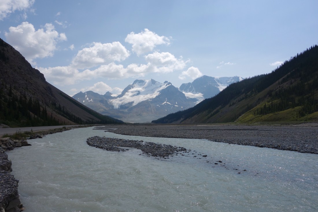
Driving down the Kenai Peninsula, on the way to Cooper Landing

Cooper Landing campsite - edited .JPG

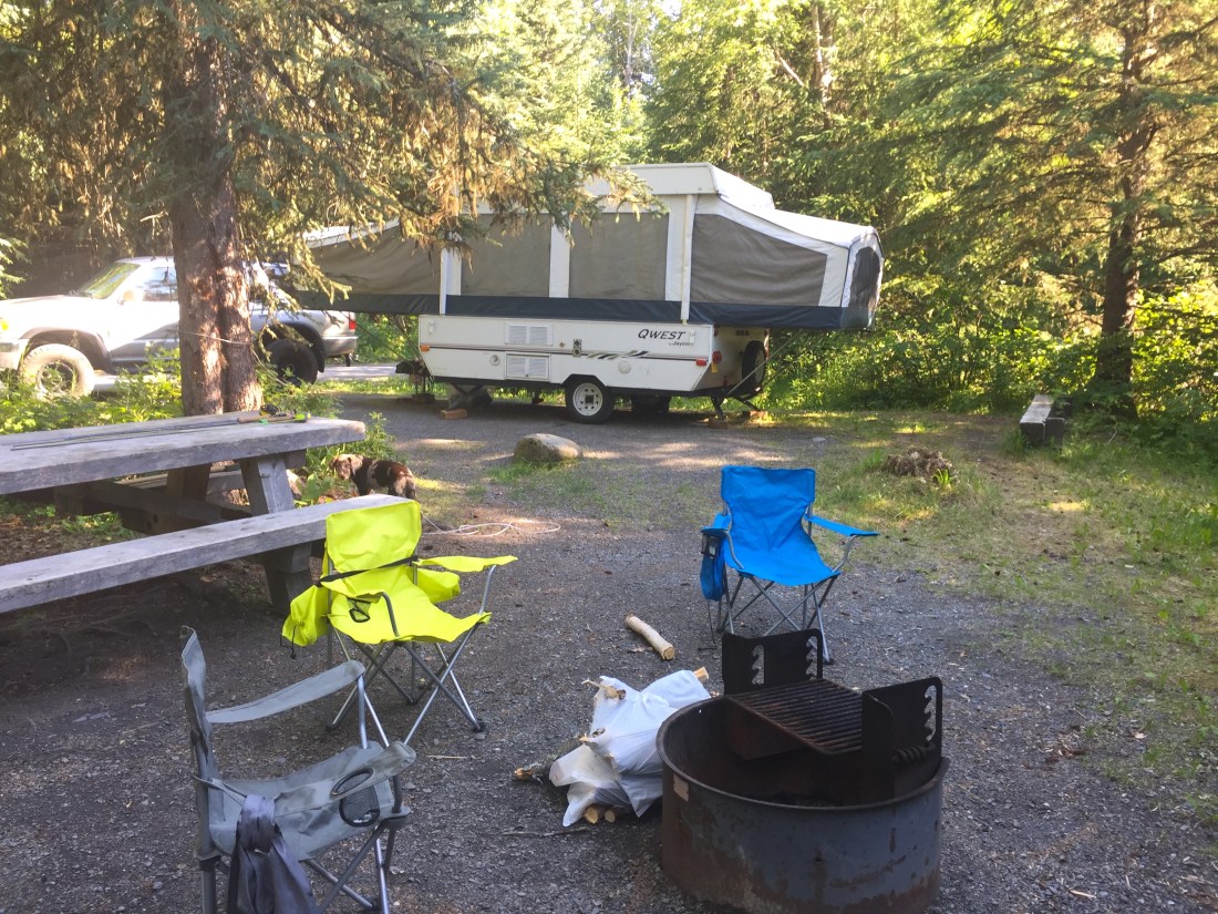
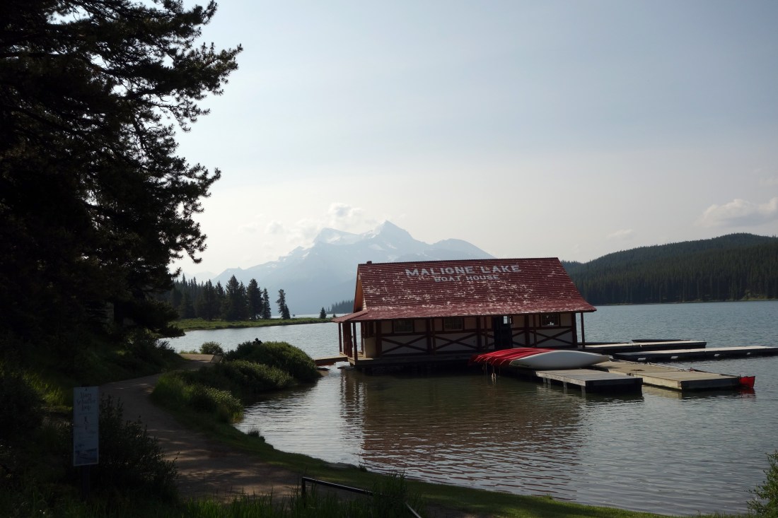
Campsite at Cooper Landing

Grizzly on Russian River .JPG

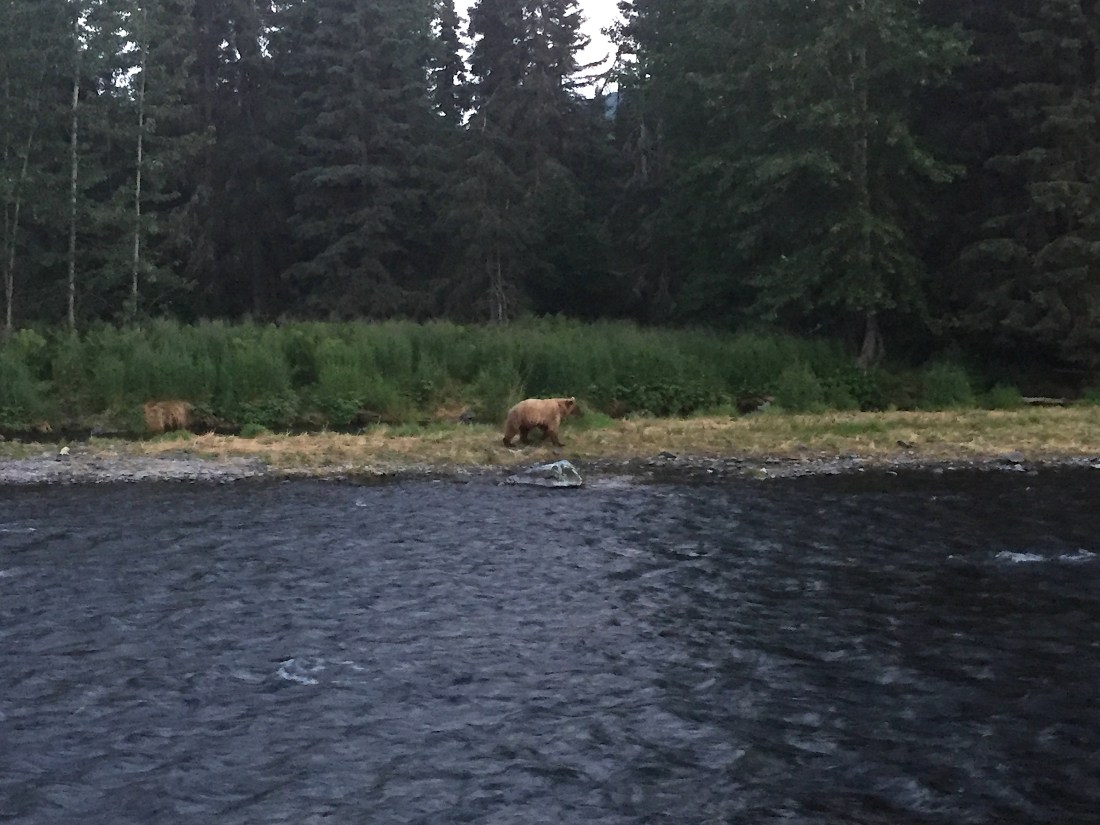
Grizzly bear at Russian River (picture taken at about 11:30pm)


Day 22 – Saturday, July 21st (Cooper Landing, AK to Eagle River, AK):

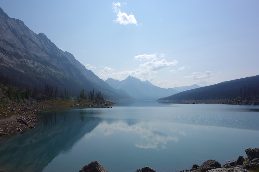
After a good breakfast, we packed up the camper and began driving back north towards Eagle River. It was such a beautiful day, with temperatures in the 70’s and not many clouds in the sky.  A few miles north of our campground, we stopped at Kenai Lake to see the sights and get a few pictures. Before we hiked down to the lake, I spoke with an older couple (maybe in their 60’s) in the parking lot that were eating lunch and taking a break from riding their bicycles. Come to find out, they left Florida 6 months ago and rode all the way to Alaska! They mentioned that they had one week left in Alaska before they would begin riding all the way back to Florida. And I thought my trip was a long one!

The water at Kenai Lake was blueish green and the mountains a dark green, which made for beautiful scenery! J.J. and I found a cliff area that was about 20-25 feet above the water and after determining the water was deep enough, we both decided to jump in. When I finally hit the water, I lost my breath immediately because the water was so cold, but it was a great experience!

We then headed to Anchorage and got lunch at Moose’s Tooth Pub and Pizzeria (highly recommend!) and then back to Eagle River for the rest of the day. Although we didnt catch any fish, it was still a fun trip!

Kenai Lake - edited .JPG

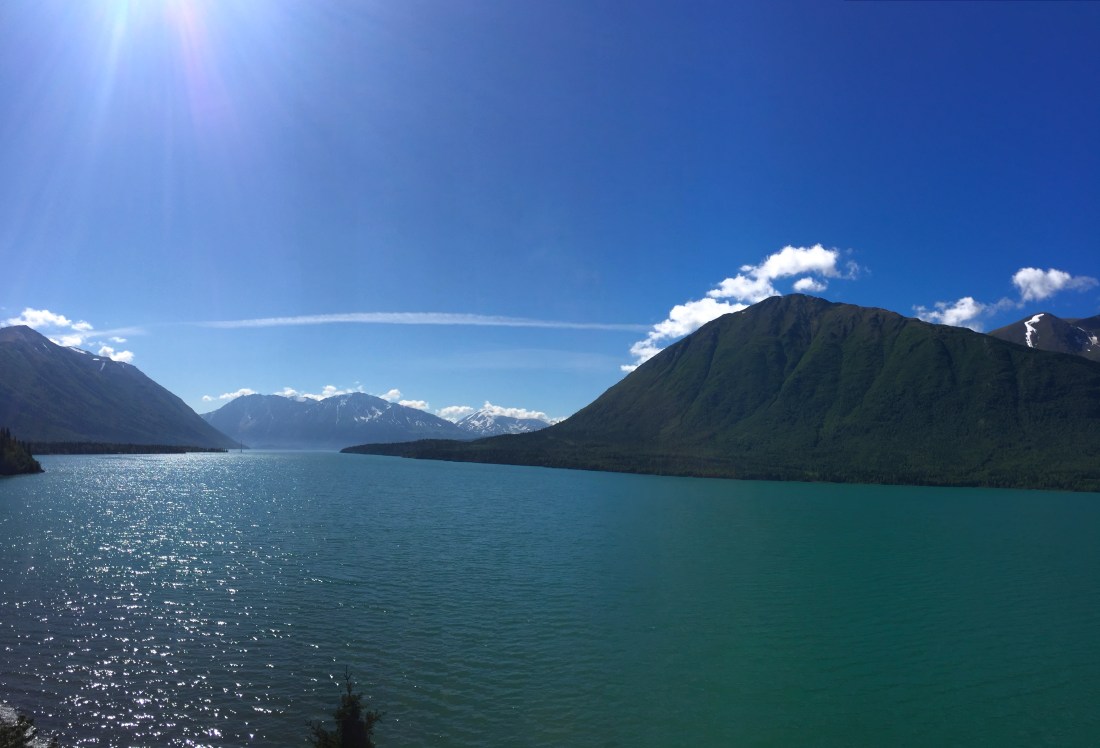
Kenai Lake – the water was cold!


Day 23 – Sunday, July 22nd (Eagle River, AK):

Today, most of the day was spent fishing. This morning J.J. and I headed to Bear Creek, a little south of Anchorage to begin fishing. Overall, there were about 50 people total fishing in this spot. We spent about three hours here and J.J. was the only one that caught anything, but I still enjoyed being there in the outdoors on a great day.

After Bear Creek, we then headed north to an amazing spot called the Hay Flats. This was a much different setting than Bear Creek, with less people and a much smaller stream to fish from. We stayed here for a few hours but unfortunately left with no fish to show for our effort. We still had an enjoyable time though!

We headed back to the house in Eagle River and hung out for the rest of the evening. Tomorrow I get back on the road and begin my trip back towards Atlanta!

Bear Creek - edited .JPG

Fishing at Bear Creek

Bear print - Bear Creek - edited .JPG

We weren’t the only ones fishing at Bear Creek! Grizzly bears are frequently seen here. The day before we came here, grizzly bears were charging fisherman and stealing their fish.
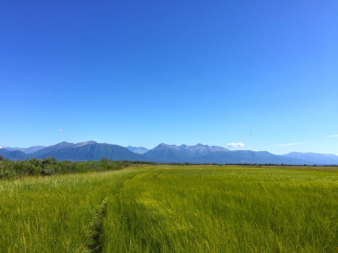
Hay Flats .JPG

Hay Flats

Hay Flats creek - edited .JPG

Fishing at the Hay Flats during low tide. At high tide, the water covers all of this mud.