Flying High! (day 20)

Day 20 – Thursday, July 19th (345, Fairbanks, AK to Eagle River, AK):

Today was an amazing day, one of the best of the trip so far! I felt great after a good nights rest in Fairbanks and began eagerly riding to Talkeetna for my flight seeing tour.

The drive out of Fairbanks, down to the Denali National Park area, and into Talkeetna was very pretty. The mountains around Denali NP were great to see and made the ride an enjoyable one. I unfortunately didn’t have much time to stop because I was already running a few minutes behind for my flight seeing tour, so I had to put the pedal to the metal to make sure I dint miss the tour completely. I would have loved to visit Denali NP but due to the time constraints and because I substituted Denali for the time I spent on the Dalton Highway, I was unable to visit the park on this trip.

I arrived in Talkeetna, a small, tourist town a few hours south of Denali NP, around 12:45pm, for my 1pm flight seeing tour with K2 Aviation. The weather couldn’t have been better! It was around 70 degrees and sunny, with few clouds in the sky. The plane we took on the tour had about a total of 10 people on board, including myself and the single pilot. I was lucky enough to be able to sit in the co-pilot seat, giving me a window to see out in front of me as well as one to my right side. This was definitely the best seat on the plane!

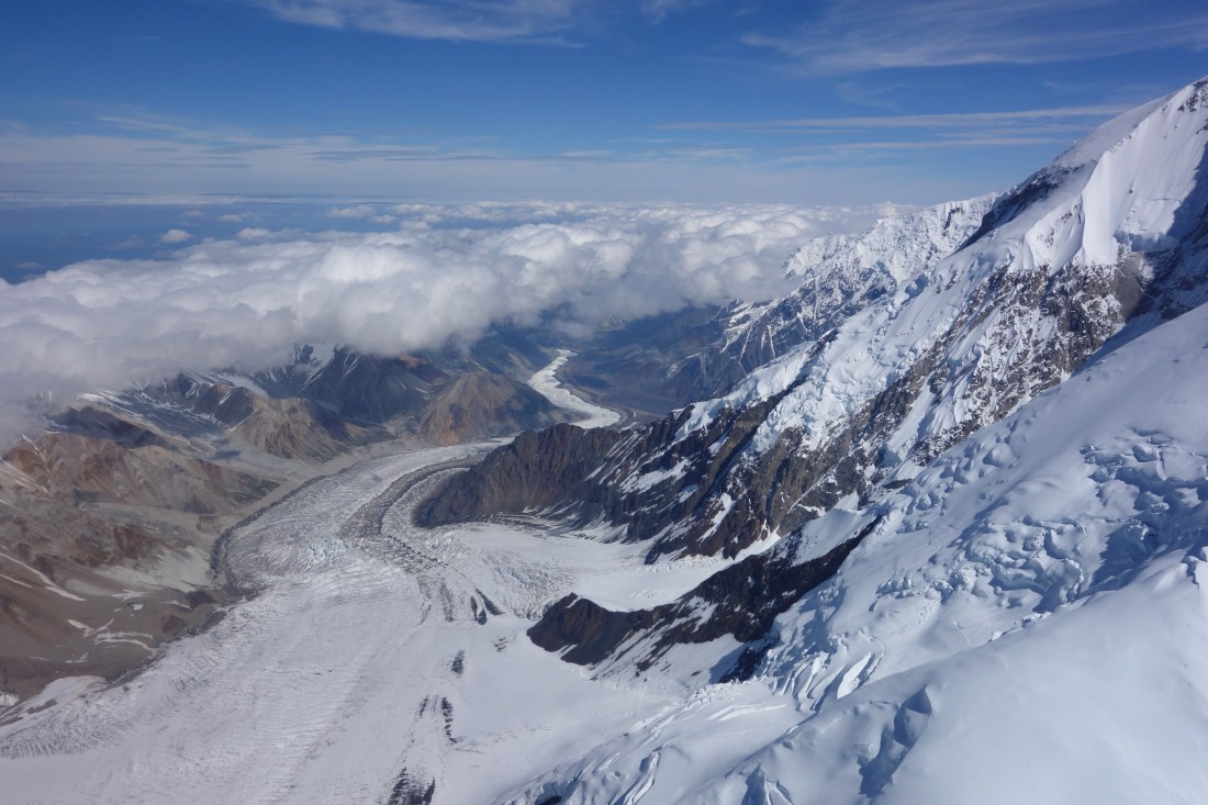
The whole flight seeing tour was such an incredible experience, something I will never forget! The views from the plane couldn’t have been better, especially since there were not many clouds to obstruct the view.

We flew around the snow covered Denali and a few other large mountains, admiring their sheer size and beauty. We could see so many glaciers, lakes, and rivers below us, as well as the numerous mountains making up the surrounding range. Absolutely stunning scenery! About an hour and a half into the flight, we landed on a glacier for about 20 minutes so that we could get off of the plane to walk around and take photos. We then got back in the plane and flew for another 30-45 minutes back to Talkeetna.

This tour was something that I will never forget and would recommend to anyone visiting Alaska!

Leaving Talkeeta, I drove south towards Anchorage for about 2 hours until I reached the town of Eagle River. One of my best friends that I have known since elementary school, J.J., is in the Army and lives in Eagle River with his wife, Alex. I will be staying with J.J. and Alex for the next 4 nights and we go camping and fishing on the Kenai Peninsula.

I arrived in Eagle River around dinner time and relaxed for the rest of the day with J.J. and Alex. I look forward to being off of my bike for the next few days!

flight seeing tour 2 - beginning - edited.JPG

View of a large glacier at the beginning of flight seeing tour

Flight seeing tour 1 - mountains and glacier - edited .JPG

Close up views of the mountains and glaciers
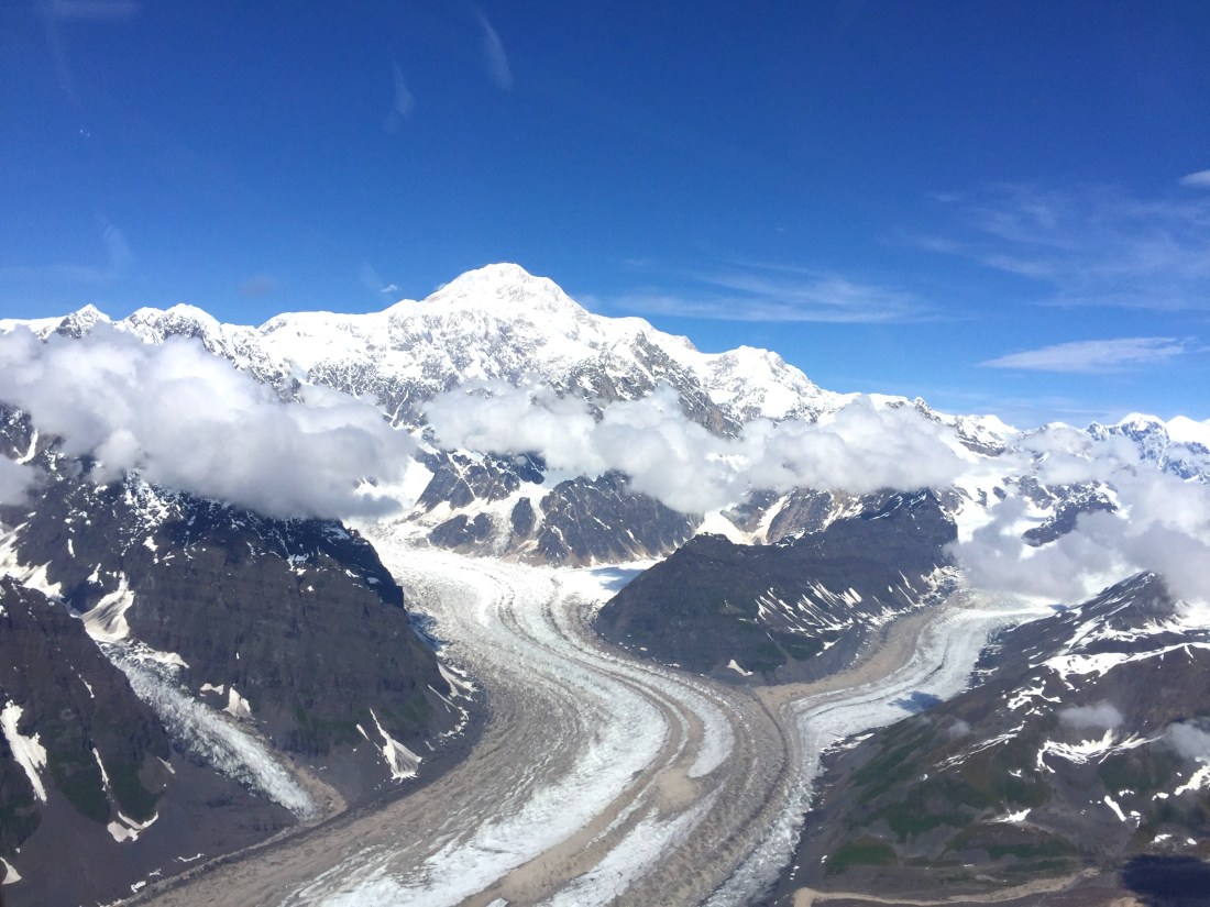
Denali and Glaciers .JPG

Denali

Flight seeing tour 3 - snowy mountains - edited .JPG

So much snow!

Plane on Glacier in Denali NP.JPG

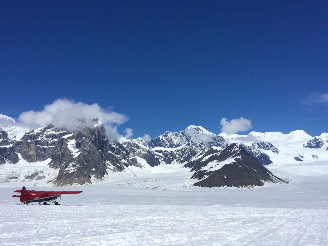
Landed on the glacier

Flight seeing tour 4 - multiple planes on glacier - edited.JPG

Beautiful day to be on a glacier!


Dalton Highway, Part 2 (days 18-19)

Day 18 – Tuesday, July 17th (390 miles, 3 miles north of Yukon River Camp to Pump Station 2, Dalton Highway, then back to Coldfoot):

Yun and I left our campsite this morning around around 7am, with the goal of reaching Deadhorse. It was a cold morning, but thankfully there was no rain. The dirt/gravel parts of the road were rough the entire way, with many potholes. Surprisingly though, there was more pavement today than I would have expected.

When we reached the the Arctic Circle sign, we stopped and took a few pictures. I couldn’t believe I had ridden than far north! We continued riding until Coldfoot (around 11am), where we filled up our gas tanks and walked inside to pay and eat some lunch. It was neat experiencing a small camp like this that is so vital to the truckers driving the Dalton year round. After lunch, the temperature warmed up to around 60 degrees or so, which was a great relief and allowed me to shed some of the layers I had been wearing.

The ride today was absolutely beautiful! The Dalton follows the Alaskan Pipeline, winding through mountains, over rivers, and through the tundra. It was a great experience to be riding on this road and somehow my bike managed to stay in one piece! By far, the hardest part of the road was avoiding the potholes as there were so many of them.

We hit some construction work and a one lane road north of Coldfoot and had to wait for about 10 minutes before we were allowed to continue. The road in this area was extremely slippery as it was all dirt and there had been some light rain earlier in the day. Although I thought that my bike might slip and go down, I was able to avoid this since I took the road slowly.

One of the scariest parts of the Dalton Highway for me was the Atigun Pass. This pass is roughly 170 miles south of Deadhorse and the road here is extremely steep and narrow. To make things a little more difficult, it had snowed here 2 inches in the morning and by the time we had arrived in the afternoon, most of the snow had melted and left some very slippery mud roads. Needless to say, I took the pass as slow as I could.

When Yun and I reached the top of the pass, we stopped to admire the scenery for a few minutes. The views were amazing from the top! Leaving the top of the pass, I went ahead of Yun so I could take it slowly, knowing he would catch up shortly after. The road after Atigun pass ran through the open tundra and was one of the most beautiful places I have seen. There were mountains, lakes, rivers, and the pipeline, but that was about it. No trees or plants grow this far north, only grass grows in the tundra.

The road in this area seemed to have a lot more potholes than what I had experience before. I was driving very slow to avoid as many as I could, but I was still hitting some periodically. At the Pump Station 2 for the pipeline, about 105 miles south of Deadhorse, I decided to turn around and head back to Coldfoot. I was only going about 15-20 miles an hour and didnt want to ride for another 4-5 hours before reaching Deadhorse and knowing that there was a chance of rain beginning in the morning. I hadn’t yet passed the “point of no return” in regards to gas, so I began the ride back through the tundra, over Atigun Pass, and back to Coldfoot.

Several hours later, around 9:30pm, I reached Coldfoot, where I stopped to get gas and eat some dinner. With the anticipated rain and also because it stays light out so late during the summer, I decided to keep riding through the night and head back to Fairbanks.

Day 19 – Wednesday, July 18th (255 miles, Coldfoot, AK to Fairbanks, AK):

I’ll never do that again! Riding through the night, by myself, on the Dalton Highway was not a favorable experience. The worst part about riding through the night was the temperature. It was so cold and even with all of my cold weather gear on, it still felt like I wasn’t wearing much.

Thankfully the ride back to Fairbanks was uneventful. It was nice to pass back by some of the beautiful areas I had ridden passed, on the way up the Dalton. There were some semi trucks that I passed but, other than that, I think I was the only other person on the Dalton in the middle of the night.

I rode into Fairbanks around 7am and stopped at a McDonalds to rest, eat, and drink lots of coffee. I hung out at the McDonalds for a while and decided that I would spend the rest of the day and night in Fairbanks so that I could make sure to get some good sleep.

I eventually got a room at the Bridgewater Hotel in Fairbanks, did some laundry, and took it easy the rest of the afternoon and evening. Tomorrow I head to Talkeetna to do a flight seeing tour over Denali National Park!

Arctic Circle sign.JPG

Stopped for a quick photo op at the Arctic Circle sign

Road outside of Coldfoot - edited .JPG

Stopped on the side of the road to take pictures with Yun’s drone; just north of Coldfoot.

Alaska Pipeline following Dalton - edited .JPG

Alaska Pipeline running parallel to the Dalton Highway

Top of Antigun Pass 2 - edited .JPG

Reached the top of Atigun Pass! 2 inches of snow fell here earlier in the morning

Top of Antigun Pass 1 - edited .JPG

View from the top of Atigun Pass. The dirt road leading north to Deadhorse runs between these mountains.

Tundra with mountains, Dalton Highway.JPG

Riding down Atigun Pass, heading north towards Deadhorse

Tundra  with road- Dalton Highway.JPG

Beautiful scenery in the tundra!

Dalton Highway (day 17)

Day 17 – Monday July 16th (135 miles, Fairbanks, AK to 3 miles north of Yukon River Camp, Dalton Highway):

After leaving the hotel this morning, I headed over to REI to pick up a new sleeping pad because the one I have been using is old and not very effective. As I was packing up my bike at REI and about to leave, Yun (guy I met a few days ago that is riding to Chile) pulled into the parking lot! We spoke for a few minutes and he mentioned that he would be riding up the Dalton Highway to Deadhorse, so he stopped at REI to pick up some last minute items.

My plan for the day was to take it easy and then begin working my way towards Denali National Park. However, after I left REI and went to grab some lunch and gas before heading to Denali, Yun texted me and asked if I wanted to join him on the ride up to Deadhorse. I loved the idea of riding to Deadhorse, but being on a cruiser motorcycle with street tires gave me reservations of making the trip. I thought about it for a few minutes, checked the weather for the next few days (partly cloudy but not much expected rain), and then told Yun I would join him! I was a little nervous about making the trip, mostly because I had heard stories of how bad the road is and I was concerned about whether or not my bike could actually make it on the road, but overall I was so excited to be doing this.

Yun and I headed over to Walmart so I could pick up a small gas can and some other supplies and then started making our way north around 3pm. We weren’t expecting to ride far today since it was so late in the day that we go started. Leaving Fairbanks, the road was paved for the first hour and a half of our ride. Around Livengood, the road then turns into dirt/gravel with potholes and rough spots. Yun and I stopped at the Dalton Highway sign to take a few pictures when one of the locals stopped to talk with us. He told me that I shouldn’t do the ride to Deadhorse with the type of bike I had, but if I did, to be careful as they have had motorcyclists die on the highway from hitting potholes and going down.

Thankfully Yun was fine riding at a slower pace for me since I had no prior experience riding off-road (besides riding to Salmon Glacier) and because I didnt have the proper bike for a trip like this. We crossed the Yukon River and arrived at the Yukon River Camp around 7:30pm and filled up our gas tanks and got some dinner. Its amazing to me that people live up here year round! During the winter, It gets as low as negative 40 degrees, if not lower, and is dark almost all day long.

Once we finished dinner, we rode a short 3 miles north to the BLM campsite, where we would stay for the night. This was surprisingly a nice, flat campsite, with potable water. We both pitched our tents and headed to bed around 11:30pm, trying to get as much sleep as possible before the long, tough day tomorrow. The goal is to reach Deadhorse by the days end!

Bikes at beginning of Dalton Highway.JPG

Yun’s bike and my bike at the beginning of Dalton Highway

Dalton Highway sign .JPG

Excited to be on the Dalton Highway! Had a little rain in the beginning.

Setting up Camp - Datlon Highway - edited .JPG

Setting up camp at the BLM campground 3 miles north of Yukon River Camp

The Last Frontier (day 16)

Day 16 – Sunday July 15th (495 miles, Haines, Junction, YT, CA to Fairbanks, AK):

Finally made it to Alaska today!

This morning I got breakfast at my motel and watched the World Cup final game between France and Croatia. I ended up leaving the motel and Haines Junction around 10am, a little later than anticipated. The weather was nice and the road followed the border of the Kluane National Park for much of the ride. I didnt stop at many places today since I got started later in the morning and had a long way to drive to make it to Fairbanks.

About 30 miles from the Canadian/Alaskan border, I ran into heavy rain that lasted for the next several hours of my ride. Making it through the border easily, I continued riding through the rain towards Fairbanks. Not only did the rain make the ride more difficult, but the subpar road conditions in Alaska added to the struggles. I was surprised at how bad the roads were once I got into Alaska; many potholes and rough spots, and a few areas of gravel.

After a long day on the road, I finally made it into Fairbanks at about 8:30pm, still soaked from the rain, but glad to be done riding for the day. I checked into a hotel and went straight to bed. Tomorrow the plan is to take it easy, wash clothes, change oil, and do a few other things before continuing on the road.

Road to Haines Junction 2 - Edited

Just north of Haines Junction, the Alaskan Highway follows the border of the Kluane National Park for many miles

Welcome to Alaska sign

Crossing into Alaska!


Getting closer to Alaska! (day 15)

Day 15 – Saturday, July 14th (355 miles, Nugget City Campground, YT, CA to Haines, Junction, YT, CA):

I slept horribly last night in my tent, maybe 4 hours total. The light that never comes out of the sky in the summer kept me up late and woke me up early. It didnt help that my cheap tent was extremely wet from condensation when I finally got up. Although I was very tired, I was excited to be getting on the road again, this time on the Alaskan Highway.

I started riding around 8:15am with with good weather and very cool temperatures. I didnt stop at many places throughout the day mainly because I wanted to cover some distance and make it into Alaska tomorrow. Several times when I stopped for gas today, I met and spoke with more motorcyclists, hearing more great stories of past trips and experiences. One couple had ridden all the way from St. Johns, Newfoundland, Canada, the furthest eastern city in all of Canada!

In the afternoon, it started to rain some so I pulled over at a small rest stop and put on my rain gear. At the same stop, another motorcyclist had pulled over to also put on his rain gear. We began talking and I asked him where he was riding from and where he was riding to. The motorcyclist, named Yun, had started his ride at his home near Washington D.C. and was riding to Alaska, just as I was. However, Yun was not returning back to D.C. after visiting Alaska. Instead, he is riding all the way through central and South America to Chile and then riding back to D.C. I almost couldn’t believe it when he told me about his trip! This was one of the most astounding things I had ever heard! I was in awe that he would do a trip like that, while doing it by himself.

Yun and I spoke for a few minutes and he mentioned he was riding to Whitehorse to get internet and food at the Tim Hortons coffee shop and I could join if I’d like. I followed him there and sat down with him to speak further and ask more questions about his trip.  Yun told me he was heading to Fairbanks once he got into Alaska (same plan I had) and that he would ride up to Deadhorse, AK (10 miles south of Arctic Ocean) from there. After about 20 minutes, I decided to get back on the road and keep riding, hoping to still put in another few hundred miles. I definitely wanted to run into Yun again and talk more about his trip and past experiences on his bike (he had done several other big motorcycle trips).

I rode several more hours after Whitehorse and made it to Haines Junction, YT. While on the ride to Haines Junction, I did see my first bald eagle and coyote. The bald eagle was definitely great to see!

After the lack of sleep I got last night, I decided to get a hotel room in Haines Junction and ended up staying at the Kluane Park Inn, a small motel with great views of the mountains and the Kluane National Park, just north of the town. Once I had moved all of my belongings into the motel room, I walked down the street to get some dinner before turning in for the night.

It was a long, tiring day, but I couldn’t be more excited to get into Alaska tomorrow!

Sign outside of Nugget City - edited .JPG

The beginning of my ride on the Alaskan Highway, just outside of the Nugget City Campground

Road to Haines Junction - Edited .JPG

Alaskan Highway on the way to Haines Junction

Cassiar Highway, Part 2 (day 14)

Day 14 – Friday, July 13th (390 miles, Stewart, BC, CA to Nugget City Campground, YT, CA):

Today was my last day riding on the Sewart Cassiar Highway. I left Stewart, BC around 8:30am, riding back towards Meziadin Junction and passing all of the mountains, waterfalls, and streams that made up some of the most amazing scenery I have ever seen in my life.

I filled up my gas tank at Meziadin Junction and rode till I reached the Bell II Lodge and gas station. While I was waiting in line for gas, I began talking with a retired couple (Brad and Candi), waiting in front of me, from Indiana that were on their way back from Alaska to Indiana. We chatted for a few minutes and then it was my turn to fill up my bike. I went inside to pay and saw Brad and Candi sitting down at one of the tables drinking coffee. I decided to grab some coffee as well and sit down for a few minutes to continue talking with both of them before getting back on the road. After a few minutes of talking with Brad and Candi, I found that this was the second time they had ridden their motorcycles to Alaska. I also found that they have taken many motorcycle trips across the US, and even some in Europe, visiting some of the most beautiful national parks and other locations that can be found in the US. Hearing them talk about the different journeys they had been on previously got me so excited for the rest of my trip as well as trips I hope to take in the future. After speaking with Brad and Candi and getting back on the road, I couldn’t stop thinking about how great it was to have these interactions with others that have done similar trips and hearing their stories and experiences. Meeting people has by far been the best aspect of the trip!

In the afternoon, rain began to come down at a steady pace, making it hard to see at times. While I was riding in the rain, going about 60 mph, a massive moose suddenly came running out of the woods about 20 yards or so up the road, on my left side. This was the first moose I have seen on the trip and almost my last! I had nearly no time to react in the situation, besides swerving some towards my right to try and avoid getting hit. As soon as the moose made it to the road, it did a u-turn right back into the woods. I don’t think my heart has ever beat so hard in my entire life! Needless to say, it would not have been a good ending had that moose continued running out into the road.

Later in the afternoon, the rain eventually subsided and the rest of the day turned out to be a fairly nice day. I continued riding until about 8:30pm, when I reached the border of British Columbia and the Yukon Territory. I pulled over to the side of the road (although there was no one else to be seen for miles and miles) and took a few pictures of the Yukon and BC signs. I stood there for a few more minutes, looking back down the road from where I had just come from, thinking about how amazing the past two days had been. I had seen a few moose, several bears, glaciers, waterfalls, huge mountains, totem poles, and met such great people on this stretch of the trip. The Cassiar was on the top of my list for places to see while on this trip and it certainly did not disappoint! This is a place I would highly recommend to anyone riding up to, or back from Alaska!

I eventually rode a few more miles down the road to the Nugget City Campground/RV Park and ate a very mediocre hamburger and camped at a mediocre campsite. While it wasn’t the most ideal location to spend the night, it was a place for me to rest up before getting on the Alaskan Highway, which would take me all the way up to Alaska.

Filling up at Gas station on Cassiar .JPG

Filling up at a gas station on the Cassiar Highway

Bell Irving River bridge crossing - Edited .JPG

Bridge over the Bell Irviing River, just north of the Bell II Lodge.

Gravel:Dirt road on Cassiar - edited .JPG

At times, the road would turn into a gravel/dirt combination, making it especially hard to ride on during the rain.

Moose on Cassiar.JPG

One of the moose I saw while riding on the Cassiar

Yukon sign with bike .JPG

Leaving British Columbia and heading into Yukon Territory

Stewart Cassiar Highway/Stewart BC/Hyder, AK/Salmon Glacier (day 13)

Day 13 – Thursday, July 12th (260 miles, Smithers, BC, CA to Stewart, BC, CA):

Best day of the trip so far! Its hard to describe just how amazing today was overall. The scenery was beautiful (best I’ve seen so far), I met some great people, the weather was near perfect, and I was able to see some wildlife – hard to beat today!

I have been looking forward to this day for a long time. Getting on the Stewart Cassiar Highway has been one of the most anticipated parts of my trip from the beginning. I left Smithers, BC around 8am and headed towards Kitwanga, BC at the southern start of the Cassiar Highway. The ride up to Kitwanga had been great; again following mountains, a river, and passing through smaller towns.

I filled my gas tank in Kitwanga then began riding north on the Cassiar Highway. My first stop on the highway was to see some totem poles in Kitwanga that had been built many years before, some well over 100 years ago, by the natives that lived in the area. Its amazing that the poles are still standing tall after all of these years!

After viewing the totem poles and taking a few pictures, I got back on my bike and continued riding north. About 20-30 miles north of Kitwanga, I watched a mom black bear and her two cubs cross the road about 30 yards ahead of me, the first bears I have seen on the trip so far. As I kept riding, I ran into some construction work and a one lane road and had to wait about 20 minutes in a line of cars and RVs before we were all able to continue going north.

My next stop was at Meziadin Lake to take in the beauty of the surrounding mountains and clear water of the lake. Almost every campsite at this lake was full from other tourists, many enjoying the scenery as well.

As I got to the Meziadin Junction, I again filled up my gas tank and took a left down Glacier Highway towards Stewart, BC and Hyder, AK. What a beautiful ride this was! Mountains and thick forests were on both sides of me with countless waterfalls and streams coming off of the mountains. I eventually came to Bear Glacier and stopped for a few pictures as this was an absolutely beautiful place and one I would recommend to anyone visiting this part of BC. I then continued riding till I got into Stewart and stopped at the visitor center to find out what my next course of action would be.

The lady at the visitor center had suggested that I take the road up to Salmon Glacier and check out the view there. She mentioned I would need to go across the border into Hyder, AK and then take the gravel and dirt road up to the glacier. At the time, I did not know how rough this gravel/dirt road would end up being, but if I had known beforehand the conditions of the road, then I may have never taken the trip up to Salmon Glacier. My bike is certainly not built for these types of roads and this was the first time I had ever ridden off-road in my life!

After my short stop at the visitor center, I got on my way and crossed the border into Hyder, AK (no border agents as Hyder is basically a ghost town) and made a stop at Fish Creek to see if any bears were around. Unfortunately for me, the salmon had not yet begun swimming up the rivers, so the bears had not come down from the mountains quite yet. I then continued to ride towards Salmon Glacier, avoiding pot holes constantly and doing my best to make sure my bike didnt go down. About halfway to the glacier, it began to rain quite hard, which made for even worse conditions and turned the dirt portions of the road into mud. I eventually made it up safely to the glacier viewpoint but could not see much as there were clouds covering the view. I stayed up at the viewpoint for about an hour, talking with other tourists and a “local legend” that goes by Bearman (from New Brunswick but drives to Stewart, BC every summer, for the entire summer), before I decided that the cloud cover would not be moving and I needed to get back down the mountain to find a place to stay for the night.

The ride back into Hyder was much quicker than the ride up the mountain and this time with no rain. I crossed back into Stewart, BC and got a hotel room at the King Edward Hotel. While I was unpacking things from my motorcycle, I met a recently retired guy on a BMW motorcycle that had ridden up to Deadhorse, AK and was now on his way back to his home in Arizona. He was also staying at the same hotel, so we decided to get dinner inside together and continue the conversation. We spoke for about an hour and then had another younger motorcyclist from Minnesota join us for a while longer. These small conversations and quick encounters with other motorcyclists have by far been the best part of the trip. Hearing the different stories, experiences, and personal backgrounds has been very enjoyable for me so far and has opened my mind to so many different perspectives.

After having dinner and conversation, I headed to bed around 10pm so that I could get an early start for the next day. Overall, an absolutely amazing day and one I will never forget!

Totem Polls 1 .JPG
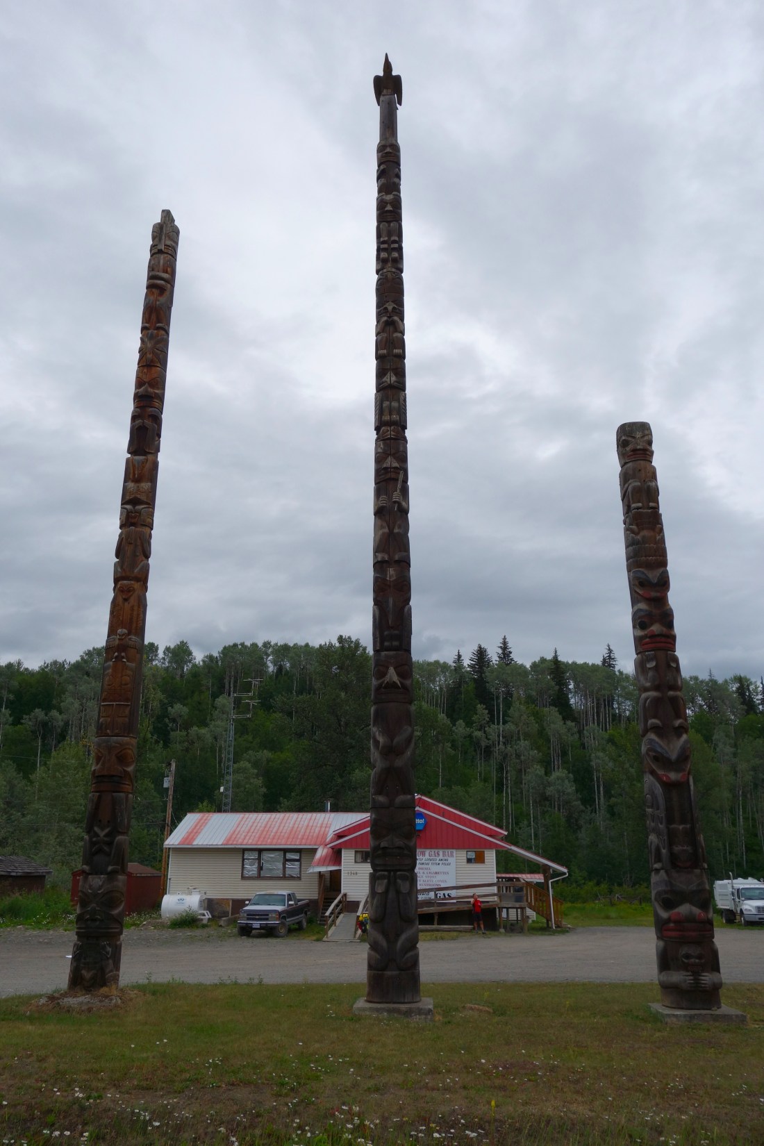
Totem Poles in Katwanga

Bear glacier with bike .JPG
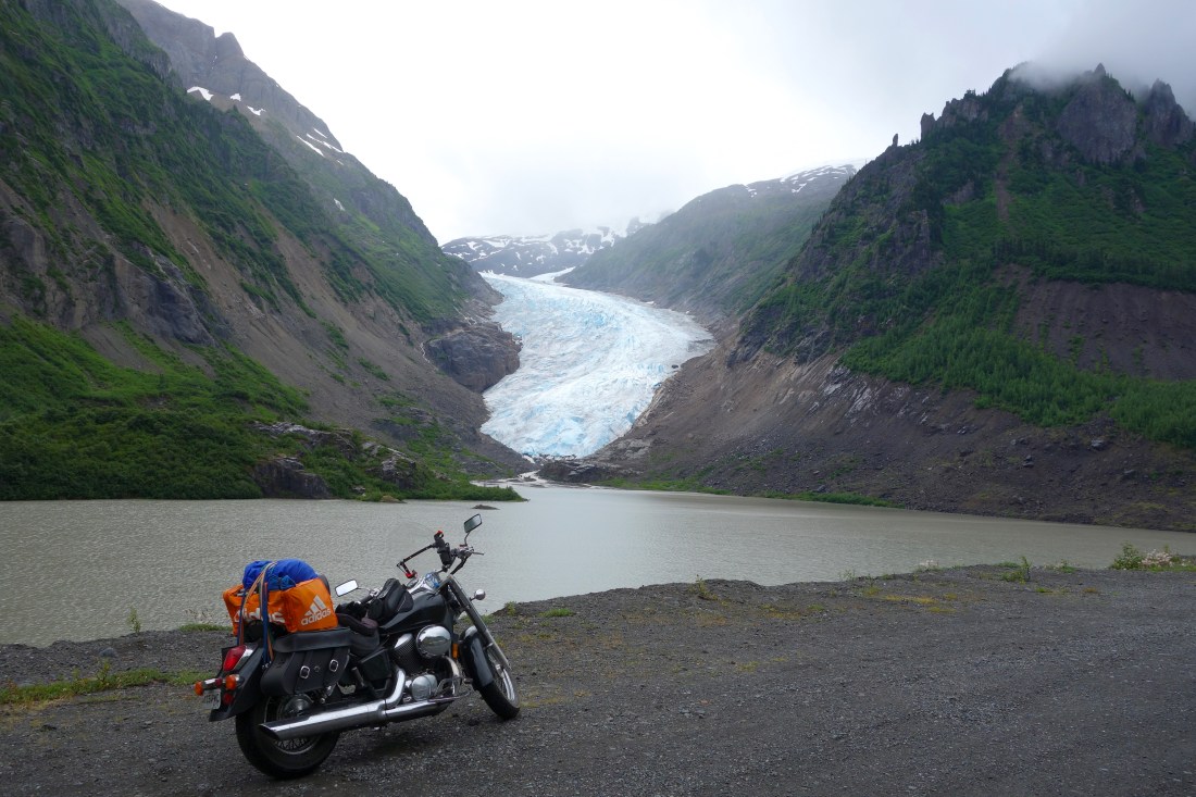
Bear Glacier on the way to Stewart, BC.

Salmon Glacier - edited 2.JPGSalmon Glacier – cloudy almost the entire time, but breathtaking view!

Oh Canada! (days 11-12)

Day 11 – Tuesday, July 11th (325 miles, Bellingham, WA to Williams Lake, British Columbia, CA):

Crossed the border today! I left my brothers house in Bellingham around 11am and headed towards the border crossing in Sumas, WA, a short ride of about 40 minutes. I made it through the border with no problems and then drove to the welcome center in Abbottsville, British Columbia to get information and maps before heading further into BC. The first hour and a half  of my trip into Canada was on a major highway, Highway 1, with some heavy traffic at times but overall a smooth ride. As I began to ride further into BC and away from the cities, the landscape changed to beautiful mountains and the road followed a river for several hundred miles. There was heavy cloud cover all day, which provided some cool weather, but I was thankfully able to avoid any rain.

A few hours into the ride, I made a quick stop in Yale, BC to walk down to the river to take a few pictures and soak in the beautiful scenery. I then continued on my way north  towards Williams Lake, BC, my final destination for the day. The ride overall was amazing and had plenty of rivers, mountains, and farmland to enjoy.

I arrived in Williams Lake around 8pm, got a campsite at the Stampede Campground, and headed to bed. Excited that I am finally in Canada!

Road in Beginning of BC
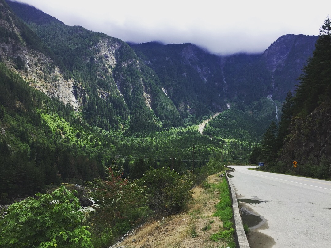
Just north of Yale, BC.

Road in beginning of BC, 2
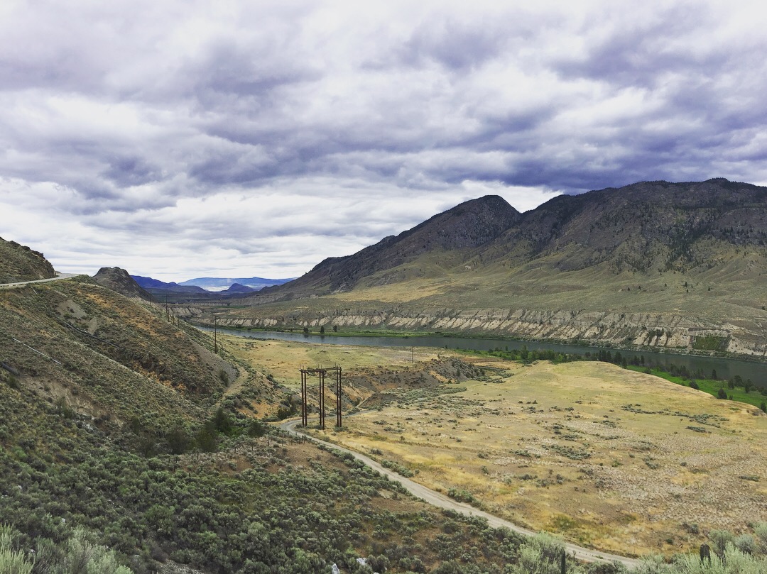
Beautiful scenery throughout the day.

Stampede Camground - edited.JPG

First night camping in Canada, at the Stampede Campground in Williams Lake, BC.


Day 12 – Wednesday, July 12th (385 miles, Williams Lake, BC, CA to Smithers, BC,CA):

I woke up this morning at what I thought was about 6am due to the amount of light already in the sky. I got out of my tent and noticed that no one else in the entire campground was awake yet, which seemed unusual to me because again, I thought it was at least 6am. I had no watch and had yet to turn on my phone to actually see what time it was until I had already been packing up my things for nearly half an hour, still wondering why no one else had gotten up. When I finally turned on my phone to see what time it was, it was only 5am!! It now made sense why I was still so tired and I only had to laugh at myself for forgetting that it gets lighter this far north much earlier than I am used to. Although I was extremely tired, it was nice to get an early start on the day.

It was much colder in the morning than I had been used to on the trip up to this point. I had all of my cold weather gear on and began riding towards Prince William. I got into Prince William around 10am, got breakfast at one of the hotels, filled up my gas tank, and then continued west.

The ride for most of the morning and early afternoon was flat and slightly boring with not much exciting scenery to enjoy. As the day progressed, the temperature warmed up nicely and the scenery became, as I began riding through mountains and thick forests. Although I was very tired most of the day, because of the lack of sleep from last night, the day ended well as I arrived in Smithers, BC. Smithers is a fairly popular skiing town with mountains and glaciers in the surrounding area.

I decided not to camp tonight because I wanted to make sure I could get a good nights rest before heading into the part of the trip that I have looked forward to the most since initially planning the trip, the Cassiar Highway.

I got a room at the Silvern Lake Trail Bnb, a house that a couple from Germany had turned into a Bnb, with incredible views of a glacier and several mountains. After dropping off my things at the Bnb, I headed back into town to grab some pizza (ate at Boston Pizza – mediocre pizza at best). I then headed back to the Bnb to call it an early night!

Couldn’t be more excited to begin my journey on the Cassiar Highway tomorrow!

Silvern Lake Trail Bnb view - edited .JPG

Not a bad view from the Silvern Lake Trail Bnb!

Continue reading “Oh Canada! (days 11-12)”

Long Days (days 9-10)

Day 9 – Sunday, July 8th (700 miles, Santa Barbara, CA to Medford, OR):

What a long day of riding! I left Santa Barbara around 6am and began riding north, with the goal of making it as far as possible by the end of the day. Ive been to California many times before and there weren’t many new places I wanted to see on my route for the day. Coming out of Santa Barbara and riding through the middle of the state with mountains and farmland was beautiful. The temperature was much cooler in the morning, around 60 degrees when I left, but quickly warmed up to the 90’s by the afternoon and hit 100 as I drove through Sacramento.

Although I didnt stop for any sightseeing today, it was still a great day of riding due to the amazing scenery. As I rode up through Northern California and Southern Oregon, the scenery changed from farmland to mountains with thick forests. This was the best scenery of the day, especially as I drove past Mount Shasta in northern California, which is a huge mountain still covered in snow!

About 10 miles south of the Oregon border, I rode through an area on Highway 5 that had recently been destroyed by wildfires. In fact, there were still fires during just off of the highway! Cars, homes, and businesses had all been burnt to the ground, thick smoke covered the entire area, police and the National Guard had nearly every exit off the highway closed, and helicopters flew overhead with large buckets of water to drop on the fires. It was a surreal experience to say the least, something that looked like it was straight out of a movie. It was sad to think about the loss of property and possessions for the people in the area, some literally lost everything they owned to these fires.

I arrived in Medford around 8:30pm and got a hotel room for the evening. It was a tough day overall due to the heat earlier and the amount of time on the bike, but overall a great day with amazing scenery.

Mt. Shasta - Northern Cali - edited .JPG
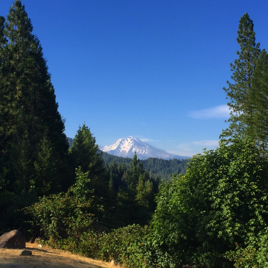
Mt. Shasta in Northern California


Day 10 – Monday, July 9th (535miles, Medford, OR to Bellingham, WA):

Today started out well, riding through the mountains in Southern Oregon with cooler weather (about 55 degrees) and light rain. I had to put on quite a bit of my cold weather gear due to the temperature and light rain in the morning, but shed all of it by the afternoon. The mountains in Southern Oregon have some of the thickest forests I have ever seen. It was extremely pretty and one of the most beautiful places I have ever ridden through.

About 20 miles south of Portland, highway 5 begins to run through suburbs and bigger cities all the way up to about 20 miles north of Seattle. This was not an enjoyable ride as the traffic was very heavy and I was almost twice by car drivers when I rode through the Seattle area. Both times the cars almost hit me, they were coming into my lane without the drivers looking or turning on their blinker signals. Because I was paying attention, I was able to lay on my horn both times and put on the brakes enough so that I could avoid being hit. It was definitely a scary situation both instances! Needless to say I will never ride through the Seattle area again on a motorcycle.

My final destination for the day was Bellingham, WA, where my brother, his wife, and their son live. I arrived in Bellingham, which is a smaller town right on the Pacific coast, around 5pm. I ate dinner with my brother and his family and then ran to the nearest Walmart to gather a few last minute items I needed before heading further north into Canada tomorrow.

Bruce in Bellingham.jpg
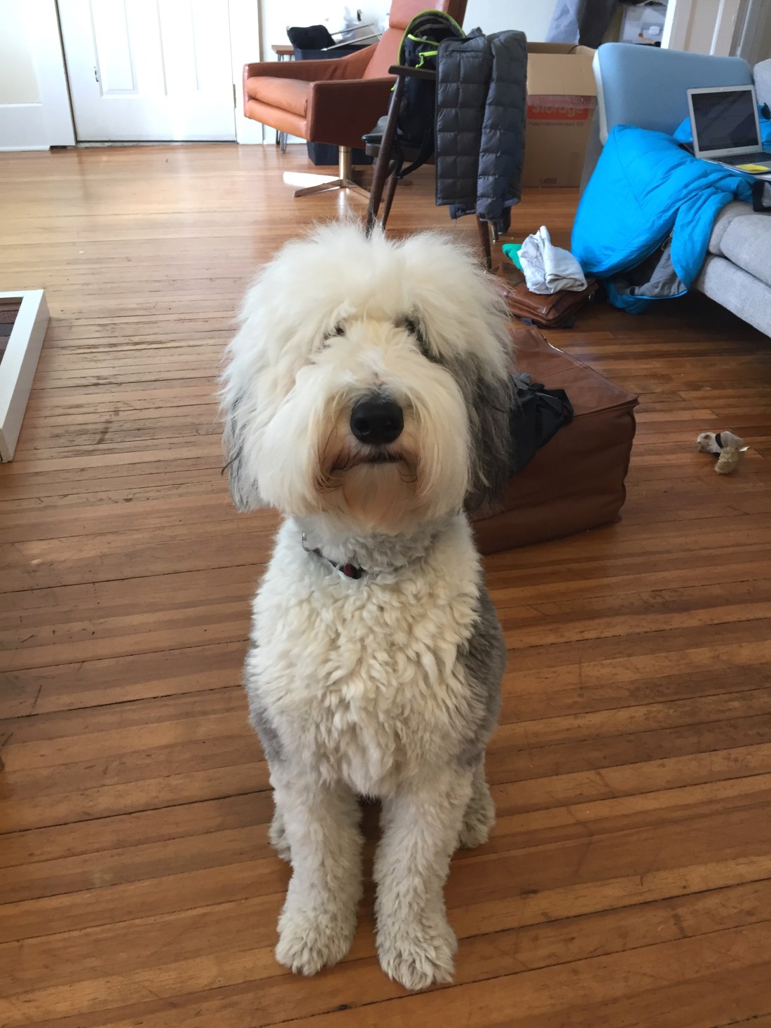
My brothers Sheepadoodle, Bruce.

California (days 7-8)

Day 7 – Friday, July 6th (120 miles, Palmdale, CA to Santa Barbara, CA):

A fairly easy and short, but hot, day today. My dad and I left Palmdale around 9am and took the highway towards the coast. As we weren’t far from Los Angeles, there was quite a bit of traffic, which made for some nervous riding. Once we got into the Ventura area, the temperature declined quickly and the weather felt amazing compared to the heat we had been riding in. After eating lunch in Ventura, I rode up highway 101 along the coast to Santa Barbara. This was such a beautiful ride with the coast and Pacific Ocean to my left! After arriving in Santa Barbara in the early afternoon, we checked into our Airbnb and then headed into town to get dinner and walk around. Santa Barbara is beautiful and definitely worth a visit if you find yourself in southern CA!


Day 8 – Saturday, July 7th (Santa Barbara, CA):

Today we didn’t do any riding on the motorcycles, which was a nice change of pace from the past few days. We spent the morning watching the World Cup soccer games at a restaurant in downtown, ate lunch, and then headed back to the Airbnb to get ready for my cousins wedding that evening.

The reception for the wedding was at the Sea Center on the Santa Barbara Pier, which had amazing views and even better weather! The cooler weather and breeze was a great relief from the extreme heat we had been experiencing over the last week.

After the wedding and reception, I headed back to the Airbnb to finish organizing and re-pack my things. Tomorrow I begin the rest of the trip by myself, riding north towards Canada and Alaska!

Santa Barara - Pier, wedding reception
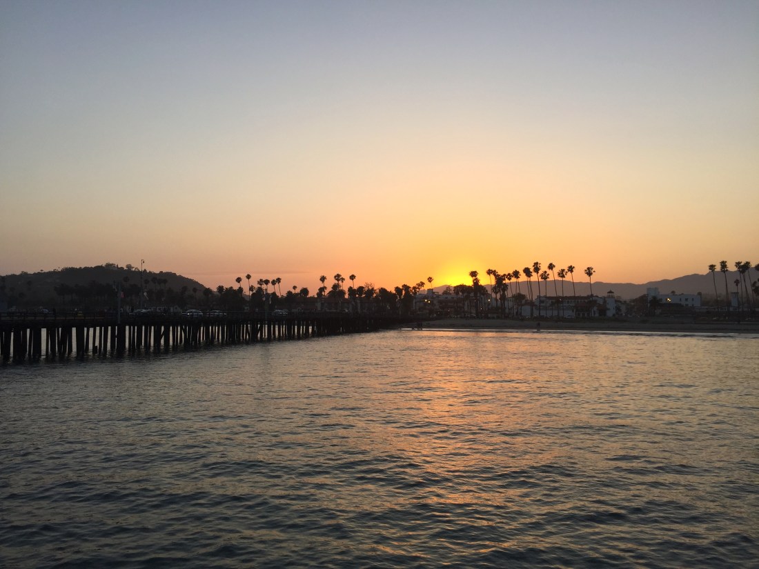
View from the Santa Barbara Pier at night